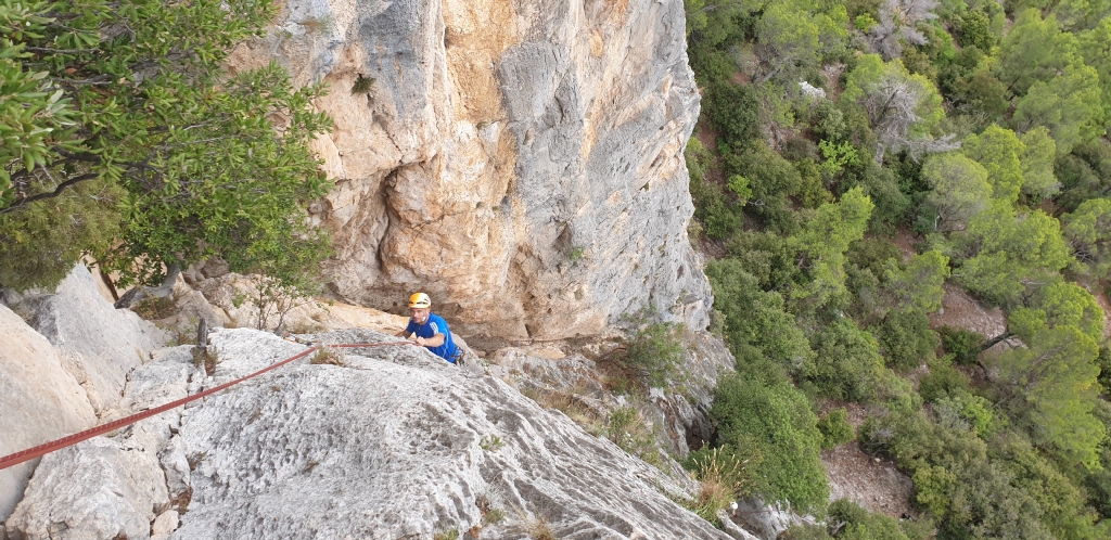
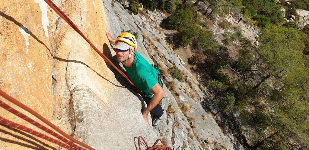
We put here at your disposal original topos of track opened by Jean-Christian Lichaire and his companions.
These routes are in the Alps and more particularly in Maurienne and Aussois.
Warning
Remember that you are responsible for your shopping and in no case these topos do not exempt you from taking all necessary precautions. Be aware of reported difficulty levels, recommended equipment, necessary equipment and approximate times indicated.
A good piece of caution is to be accompanied by a mountain professional.
Respect the places
Thank you to be careful to preserve the environment in which you will evolve and not to touch the equipment installed to facilitate your race and those of those who will follow you.
For any reservation request, please contact me directly by phone + 33 (0) 6 85 75 36 20 or by email via the contact form.
THE CLIMBING AREAS
Dentelles de Montmirail
Voies d ‘escalade de 20 m a 250 m .Du 3 A a 7 C
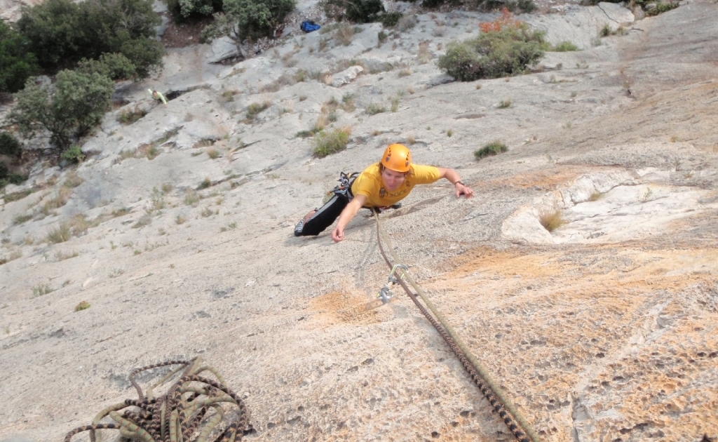
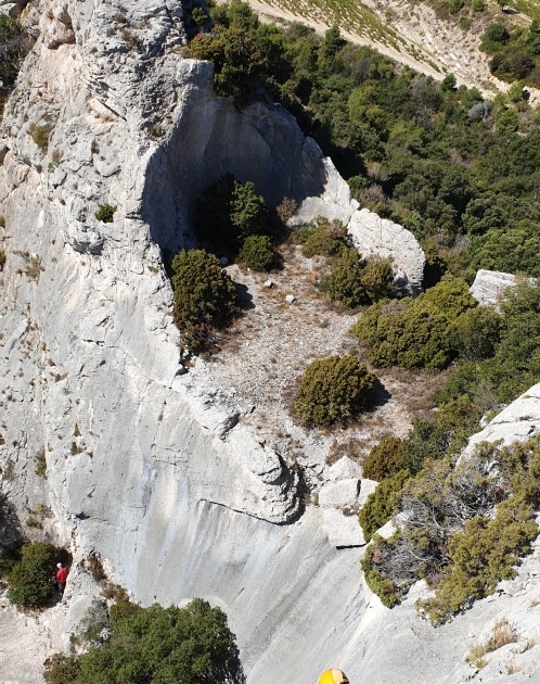
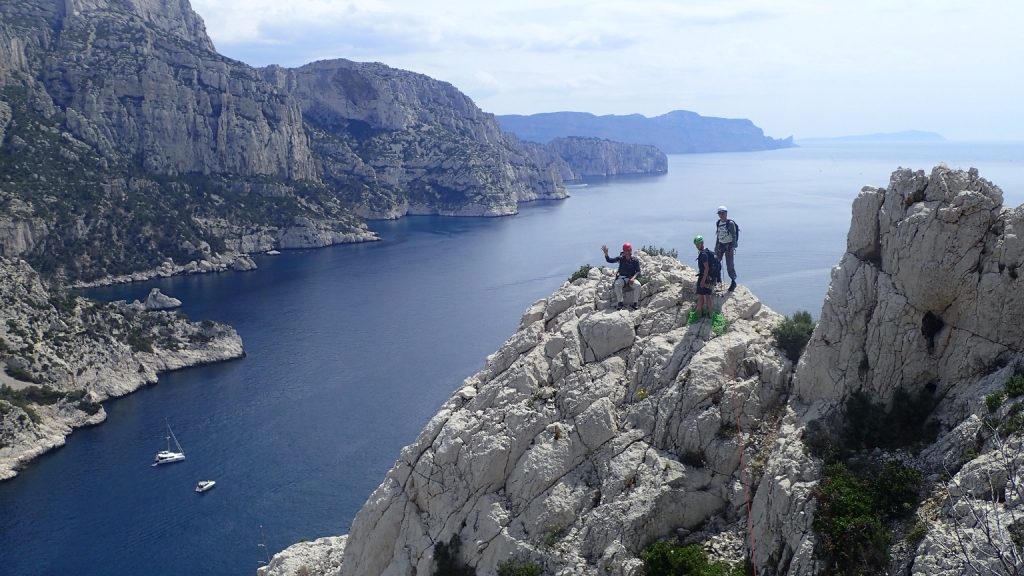
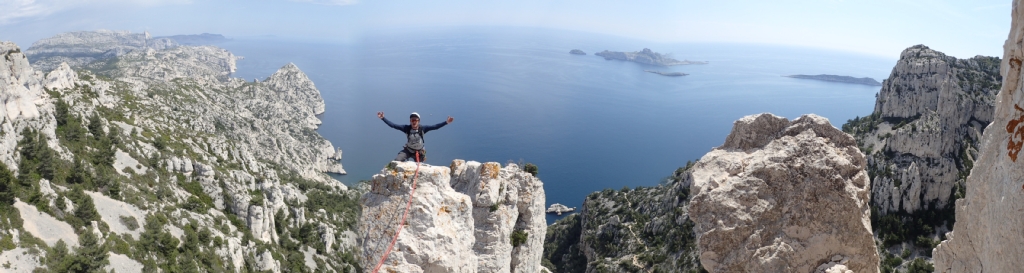
Calanques de Marseille
Voie D’escalade de 20 a 200 m .de tous niveaux 3 A a 7 C
Buis les baronnies
Voies d’escalade de 20 m a 120 m . Tous niveaux

Caroux
Voie d’escalade de 20 a 350 m . tous niveaux
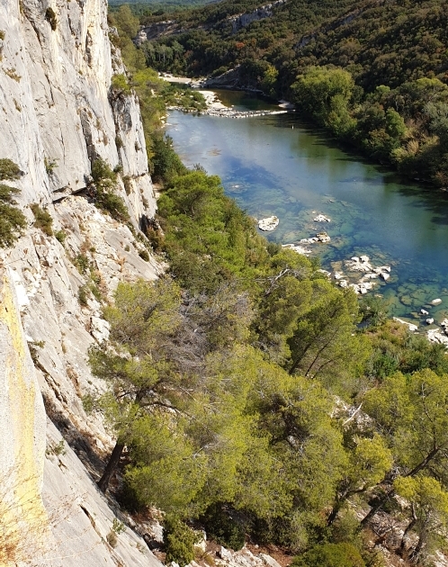
Collias
Voies d’escalade de 20 a 60 mètres .Tous niveaux
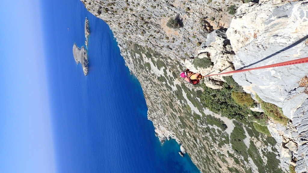
Kalymnos (Grece)
Voies d’escalade de 20 m a 250 m .Du 3 A au 7 C
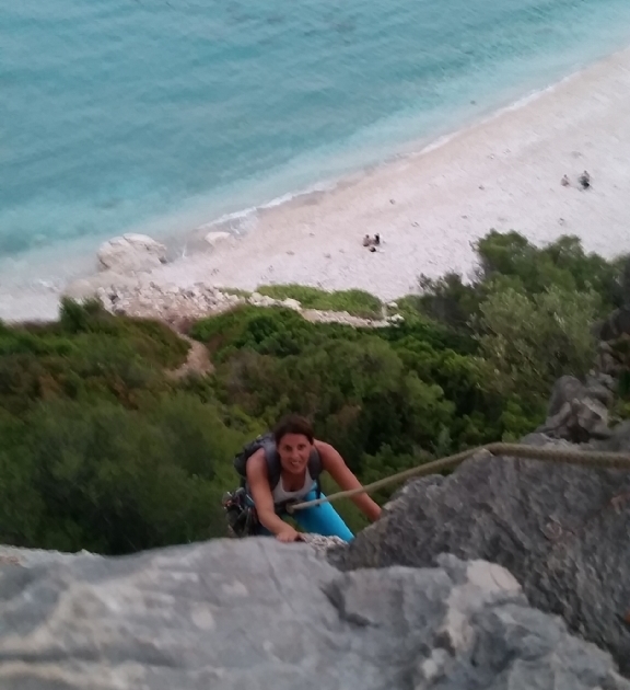
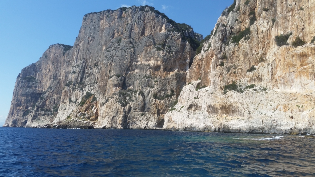
Sardaigne (italie)
Voies d’escalade tous niveaux de 20 m a 200 mètres
OPENING TOPOS
Micro Big Wall de la Parrachée (Topo)
9 new routes for climbing or learning high mountain in big shoes equipped with spits, relays and chains by Jean-Christian Lichaire
An ideal site for initiation and where training sessions in the high mountains, 3 minutes from the Dent de Parrachée refuge
Exposition : south
Rocher :
Point de Départ : 3 minutes from the Dent de Parrachée refuge
Hauteur : All quotations
Difficulté : from 3a to 7a according to the ways
Equipement :
Material : 60 Spits – relais + chain.
Horaires :
Download the topo in pdf : Topo Micro big wall de la Parrachée fond noir
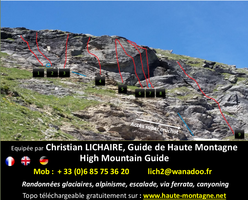
Itinéraires, plusieurs voies avec des niveaux différents:
- Dure équation : (3a+3b)/2 = 3 ?
- La fastoche : 3b
- GR5 : 4a
- Super saucisson :5c (Athlétique à l’ancienne)
- Monte tes grosses fesses : 6a
- Ventouses de cabinet : 6b
- Suce le rocher : 6c
- T’as peur et tu vas tomber : 7a
- Super cruchot : 4b Longueur : 25 mètres. Suréquipée pour grimper en tête . Accès par le bas.
3 nouvelles voies ont été équipées cet été 2020 pour compléter l’école d’escalade sur le secteur de droite de Micro Big Wall
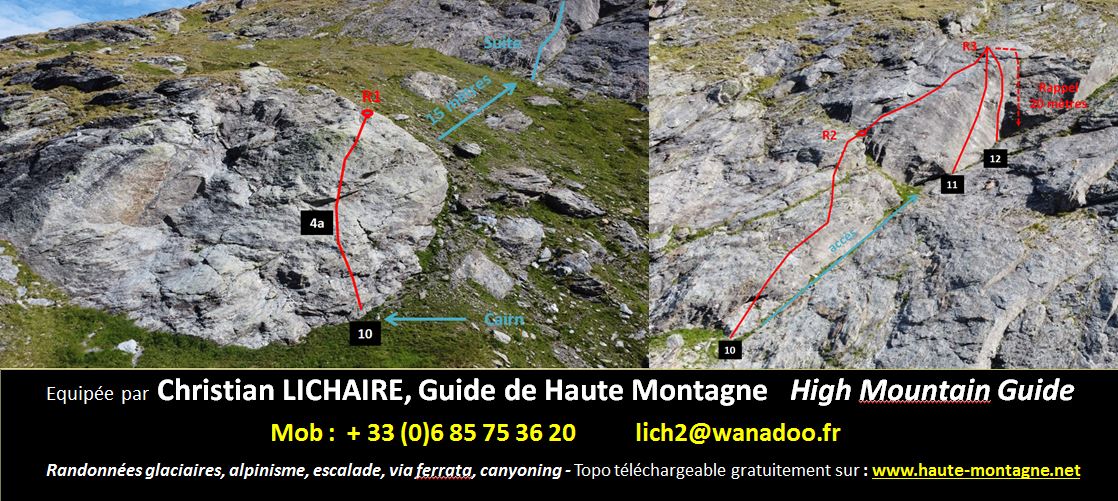
- 10. Franck, monte-moi la bière : 4a – 4a – 3c
- 11. Border line : 7a+ / 7b (cotation à confirmer)
- 12. La nettoyeuse : 6a
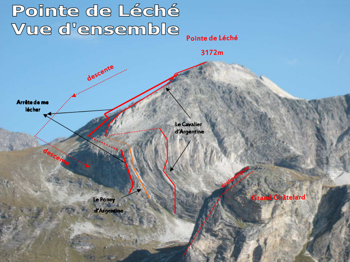
Arête De Me Lécher (Topo)
Beautiful quartzite track to start second or to improve in mind. It is possible to follow on the second part “The Rider of Argentina”, of the same level.
Exposition : South
Rock : very hard quartzite
Point de Départ : Refuge de la Parrachée
Height: 150 metres – 5 lengths
Difficulty: AD, 4b maxi
Equipement : Spits provided by the Commune of Aussois, the way is equipped. Relay on chain. Do not touch the equipment in place.
Material : 10 quickdraws, helmet, rope: 1 rappel of 40 meters unless one goes on the 2nd part of the way “the Rider of Argentina” (2 x 50m)
Horaires
From the refuge to the foot of the track : 30 minutes
The track : 2 hours and30 – Descent, from the summit to Refuge de la Parrachée : 30 minutes
Download the topo in pdf : Topo complet Arrête de me lécher
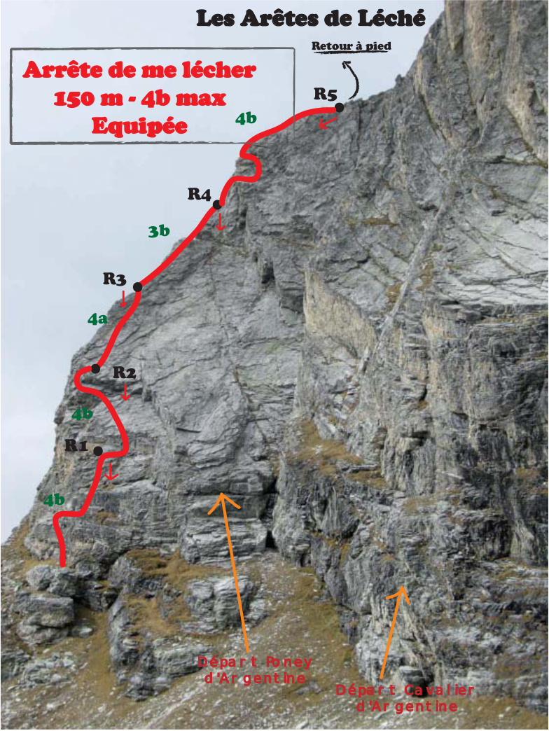
Itineraries :
From the Parrachée refuge, follow the path that goes towards the Parrachée pass. At the Grand Châtelard (on his right), you must leave the path and go to the edges of Léché (on his left, around 2750m altitude). The path starts 50m to the left of the Pony. Along the cliff on the left, pass a fault (red stick at the start).
L1: 4B
L2: 4B
L3: 4A
L4: 3B
L6: 4B
Descent: Possible reminder, but it is much faster to descend by the path that leads back to the foot of the track
Arête du Soleil - Pointe de Labby (Topo)
Very nice aerial and varied race in good rock allowing to improve the High Mountain.
Opening : In september 2003 by Jean – Christian LICHAIRE and Olivier THIERY
Exhibition: Ridge race in the sun all day
Starting point : Refuge de la Parrachée
Altitude difference : 1000m from refuge to the top la Pointe de Labby
Difficulty : AD – 4C maximum in excellent rock. Snow and rock. 400 meters in length. Beautiful aerial and varied ridge race in climbing, de-escalation, oppositions, 4 rappels (3 of 10m and 1 of 20m).
Equipement : 55 spits, reminders and relays are equipped. Do not touch the equipment in place.
Material : 1 ice ax, crampons, 2 pins, 1 strand of 45m, helmet, 6 quickdraws, 4 carabiners, 3 large straps, (2 means friends optional)
Horaires
From refuge to col de Rosoire : 3 heures
From passage de Rosoire to Pointe de Labby : 3 à 4 heures
Descent : 2 hours from Pointe de Labby to Refuge de la Parrachée
Descent : It is done by the normal way of Labby Point
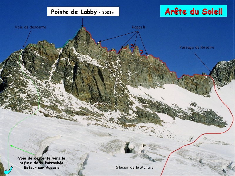
Route
Most of the route is on the edge of the ridge, except for the two central points that rise to the Pralognan From the Parrachée refuge, climb Labby Pass and cross the Mahure Glacier and climb to Rosoire Passage. From the Rosoire pass, head towards Labby Point, between two rocky cliffs and follow the ridge. Go to the left of a first gendarme, then de-escalate two projections (2 spits) to get to the foot of a vertical wall (relay). Attack the ridge above, first east then west, and relay at the top (4B). Continue the edge on the wire until relay in a slab. Go straight up to go relay at the top (4B) pouring Mauritian. Follow the wire of the aerial ridge, until an athletic passage to cross on the wire (4C) then relay. Cross on thin red slats and continue until you reach a Tarentaise slope of 10m. Continue under the ridge and then by a short jump join the wire. We arrive at the first big point. To circumvent it by the right and to climb it by a chimney (4C) 3 spits. Relay at the top. Head towards Labby Point to find the rappel line. We arrive at the foot of the second peak. To circumvent it by the right to the middle and to climb a dihedron (4B) 3 spits, at the top to pass between two blades to make relay on the other face. From here, descend 3 meters to a turn then follow it (1 spit) to the boulders and find the reminder to the left. At the foot of the reminder, relay and climb towards a keyhole, cross it and relay to the right. Descaling the aerial ridge, then follow it on the wire until the 4th rappel. Then climb Maurienne up to a passage in opposition (3 spits, 4B) and continue on the wire to the summit of Labby Point.
Le Cavalier d’Argentine (Topo)
Open Path in honor of James CHEVALIER, Mountain Guide, died in 2004
Beautiful quartzite way to perfect mountaineering; the second part can be done alone or by coupling it with the way Tirelipompon
Opening : In october 2004 and september 2005 byJean – Christian LICHAIRE, Olivier THIERY Laurent DESCHAMPS and Bruno PUTELLI
Exposition : South
Rock : very hard Quartzite
Starting point : Refuge de la Parrachée
Height : 420 meters including 400 m climbing – 12 lengths
Difficulty: D+ (1 first part), AD (second part), 5c obligatory
Equipement : 85 spits, reminders and track are equipped. Do not touch the equipment in place.
Material : 12 quickdraws, 4 carabiners, rope: 1 50-meter rappel (2x50m), helmet
Times
From the refuge to the foot of the track : 30 minutes
The track : 4 hours 30
Descent from summit to the refuge de la Parrachée : 50 minutes
Download the topo in pdf : Topo complet Cavalier d’Argentine

Route
From the Parrachée refuge, follow the path that goes towards the Parrachée pass. At the Grand Châtelard (on his right), you have to leave the path and go towards the edges of the Eché (on his left, around the altitude 2750m). The way starts on the left of a big block (cairn with the foot).
L1 : 5B
L2 : 5B
L3 : 3C
L4 : 4C
L5 : 5C
L6 : 5A
At the exit of L6, cross 60 meters on the left to catch a ridge at the lowest
L7 : 4C
L8 : 4B
L9 : 3C
L10 : 4B
L11 : 3C
2 longueurs « randonnée »
L12 : 4B
Descent: Possible reminder, but it is much faster to descend by the path that leads back to the foot of the track
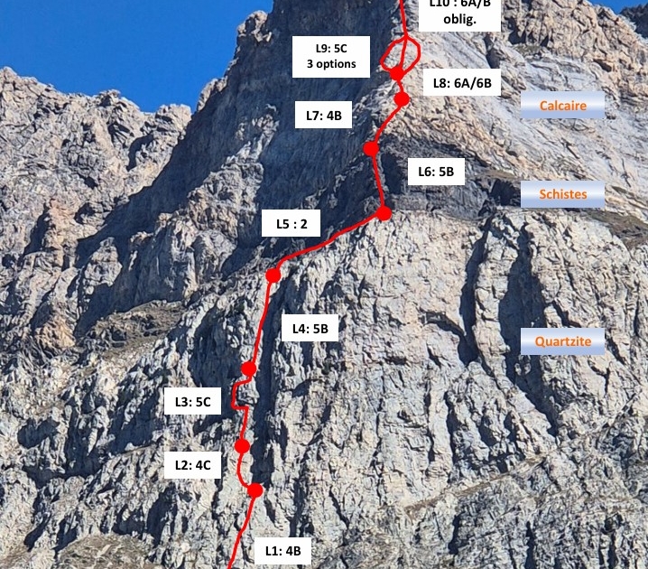
Mille-Feuille Mauriennais (Topo)
Variété géologique surprenante et étonnante à escalader – rocher de plus en plus beau au fur et à mesure de l’ascension avec une 10ème longueur superbe et aérienne.
Ouverture : En 2007 et 2008 par Jean – Christian LICHAIRE, Olivier THIERY et Fred MILLOT et Philippe NICOD
Exposition : Versant Sud
Point de Départ : Refuge du Petit Mont Cenis (Lanslebourg)
Dénivellation : 350m de voie
Difficulté : TD – 5C/6A obligatoire, 6A/B max. – Voie montagne.
Equipement : Spits fournis par le CAF de Haute Maurienne. Ne pas toucher l’équipement en place.
Matériel : casque, chaussures de montagne pour l’approche, chaussons, 14 dégaines, 2 grandes sangles, 1 rappel (2 x 50m), éventuellement 4 friends
Horaires
Approche : 50 minutes d’approche
Ascension : 5 heures d’ascension
Descente : 45 minutes
Itinéraire : 350 mètres de voie sur 3 types de rochers différents 1ère partie en Quartzite, 2ème partie en Schistes, et 3ème partie en Calcaire à goutte d’eau
Télécharger le topo en pdf : Topo 2025 Mille-feuille mauriennais; 2025 Topo Mille-Feuille Mauriennais
Itinéraire
Le début de la voie démarre à droite d’une fissure avec un spit au départ.
L1 : en 4B (équipement espacé)
L2 : 4C
L3 : longueur en S. Faire attention au tirage 5C (mettre une longue sangle).
L4 : 5B monter à la verticale puis sur la droite en rejoignant la fissure.
L5 : traverser sur la vire Schisteuse vers la droite (spit 50 mètres).
L6 : 5B longueur à la verticale. Peut être coupée en 2 sur la vire.
L7 : 4B monter en oblique vers la droite sur des gros blocs. Relais au pied d’un surplomb.
L8 : longueur en fissure en 6A/B, prises rondes.
L9 : 3 possibilités :
1) partir à gauche pour prendre pied sur une vire pour aller chercher un relais derrière un pilier pour faire la longueur d’origine en S.
2) ou du relais au dessus de la longueur en 6A/B, monter à la verticale jusqu’au relais suivant.
3) longueur directe la plus à droite qui va au relais supérieur.
L10 : au-dessus du relais, 5 mètres d’A0 puis une superbe longueur aérienne en 6A à goutte d’eau avec un calcaire adhérent ou sur la droite longueur en 6BC–6A obligatoire.
Puis continuer à la verticale sur une arête et vers une dalle, grimper toujours à la verticale, 3 spits pour aller faire relais au sommet. Suivre l’arête aérienne sur la droite en 3 jusqu’au sommet à 2643m (3 spits).
Descente : du sommet descendre dans la combe derrière et arrivé au col se diriger vers le lac du Mont-Cenis jusqu’à la ferme Mestrallet. Jusqu’à L10 la voie peut se descendre en rappel.
Mon avis : variétés géologiques surprenantes et étonnantes à escalader. Rocher de plus en plus beau au fur et à mesure de l’ascension. Dernière longueur superbe et aérienne.
Le Poney D’Argentine (Topo)
Beautiful quartzite way to start in mountaineering. It is possible to follow on the second part of the track “The Rider of Argentina”
Opening : in september 2005 byJ.C. LICHAIRE, L. DESCHAMPS, LEMAITRE, LEBON, LEMEUR,OUSTRY, BELLANTE
Exposition : South
Rock : very hard Quartzite
Starting point : Refuge de la Parrachée
Height : 150 meters – 6 lengths
Difficulty : AD, 4c maxi
Equipement : 45 spits, reminders and track are equipped. Do not touch the equipment in place.
Material : 10 quickdraws, rope: 1 rappel of 45 meters, except if one goes on the 2nd part of the way “the Rider of Argentina” (2x50m), helmet
From the refuge to the foot of the road: 30 minutes
The way : 3 hours 30
Descent from summit auto Refuge de la Parrachée : 30 minutes
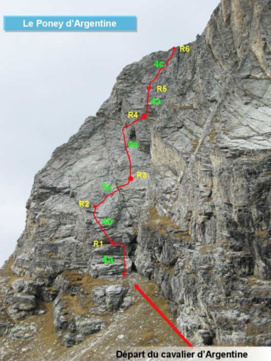
Route
From the Parrachée refuge, follow the path that goes towards the Parrachée pass. At the Grand Châtelard (on his right), you have to leave the path and go towards the edges of the Eché (on his left, around the altitude 2750m). The path starts on the left of a chimney crack (cairn at the foot).
L1: 4A L2: 4B
L3: 3C L4: 4A
L5: 4A L6: 4C
Descent : Reminder possible, but it is much faster to go back down the path that brings you back to the foot of the track.
Les Rochers Cornus (Topo)
Nice and varied aerial race in good rock on the ridge. The climb to the pass is now secure.
Opening : in 2006 by Jean – Christian LICHAIRE, Olivier THIERY, Fred MILLOT and Laurent DESCHAMPS (for the climb to the French col Passant) and complete re-equipment of the ridge in 2007
Exposition : South East Ridge Race to the North West (IGN: 3634 OT Val Cenis)
Starting point : From Modane go to Bramans then Chalets Barthélémy (2007m)
Altitude fifference : 1150m from chalets to the summit Rochers Cornus
Difficulty : Dinf – in excellent rock on the ridge, the climb to the Col de la Rognosa is now on a secure route. Mixed for the 1st part, rocky and aerial for the crossing of edge.
Equipement : 50 spits provided by the CAF Haute Maurienne. Do not touch the equipment in place.
Material : 1 light hammer, crampons, 2 spindles, 2 strands of 45m (if you have to descend from the Col de la Rognosa or 1 strand of 50m for the last reminder), helmet, 6 quickdraws, 3 large straps, 4 small to medium friends.
Times
From chalets to Rognosa pass : 3 hours 30
The crossing of the ridge : 5 hours
Descent : 1 hour 30 / (Total : 10 hours).
Download the topo in pdf : Topo Rochers Cornus
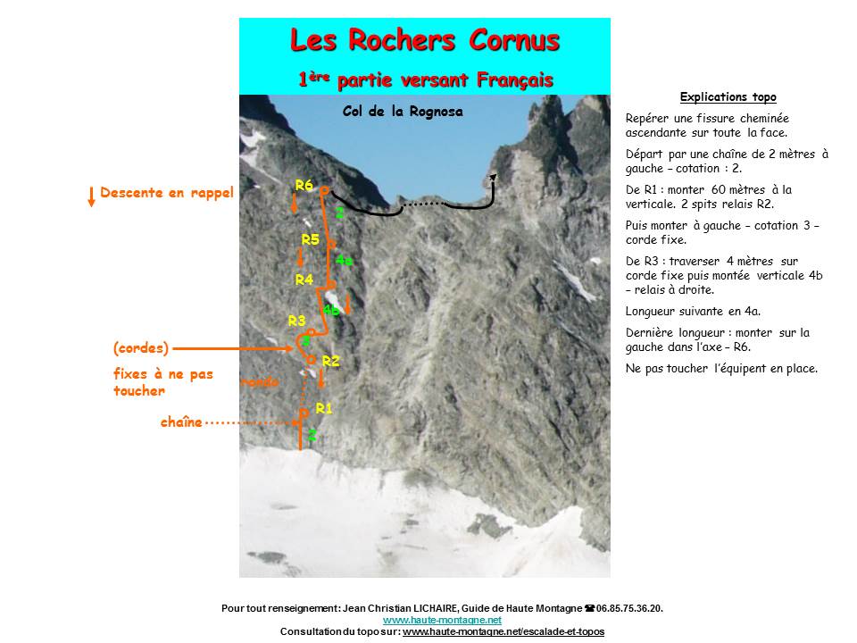
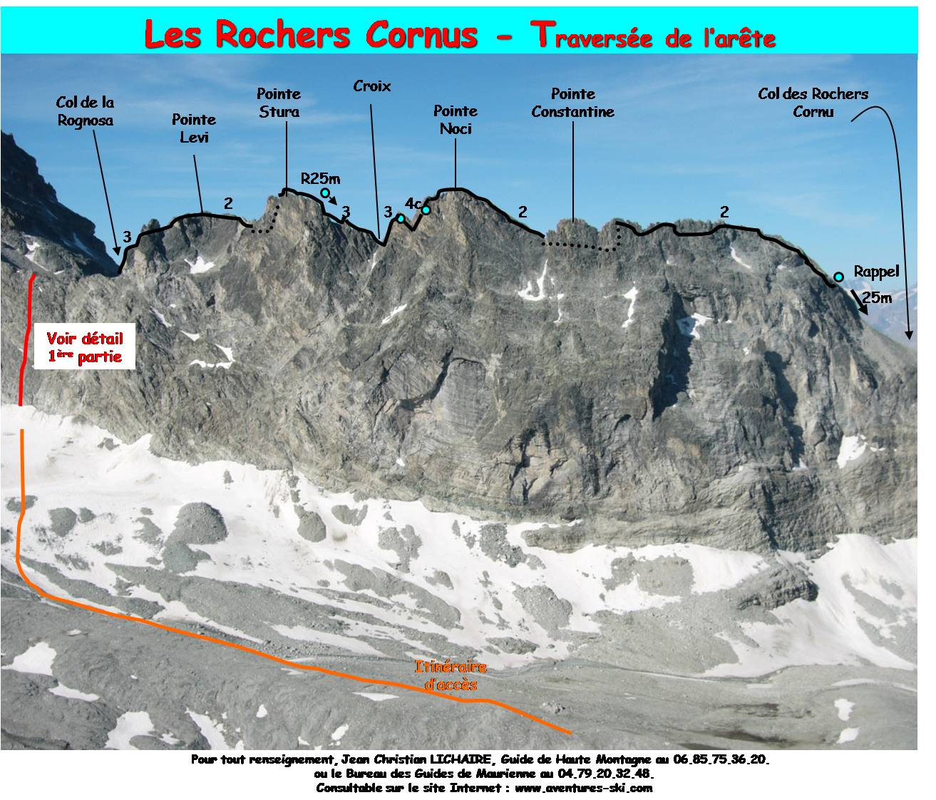
Route
Chalets St Barthélémy, follow the valley of Etache and GR Col d’Etache. Around 2100 m, cross a bridge to pass left bank and go up towards the Plan des Eaux. Leave Etache’s neck on the right side and move towards the foot of the Etache’s Beak. Go under Gros Peyron and the Cornus Rocks, go up the glacier towards Col de la Rognosa. Locate a rising chimney crack on the whole face, the departure is on the left by a chain (2). From R1: climb 60 meters vertically. 2 relay spits R2. Then go to the left (3) – fixed rope. From R3: cross 4 meters to the right on a fixed rope then climb to the vertical 4b – relay on the right. Next length in 4a. Last length: climb vertically slightly to the left – R6. From R6 you can abseil on the Etache glacier. From the pass, climb an obvious chimney, pass under a large jammed block (3) 3 spits. Cross a slab and go slightly to the right to go under a huge arch. Turn left and go up to Marina Levi Point (3140m). Through the wire of the ridge, then a series of cracks (3 spits – Italian side), to reach the Point Francesco Stura (3154m) 3 spits. Stay on the edge of the ridge (very aerial passage in 3. Spits – very aesthetic), and join a collu (small cross) or make a reminder (Italian side – relay) to join the collu the last 25 meters. Climb a jump in 3 (5 spits) then descend to the base of a light colored edge. Cross this edge in 4c (6 spits) to relay just above. Stay on the edge of the ridge to reach Sergio Noci Point (3152m). Descend at best to a collu (2) then pass Italian side, go at the end of a large ledge to go back to Pointe Piero Constantine to avoid 3 gendarmes (2975m). Continue on the wire and then by small French slopes, until you find yourself at the foot of the Col des Rochers Cornus. Do not enter a stony corridor below the Col but stay on the left spur and descend to a rappel (spits + 25m strap).
Descent : From the Col des Rochers Cornus, go back to Gros Peyron, then take the path towards the stream of Côte Cornue
Accommodation : Gîte Lavis Trafford (Phone number : +33 4 79 05 06 83)
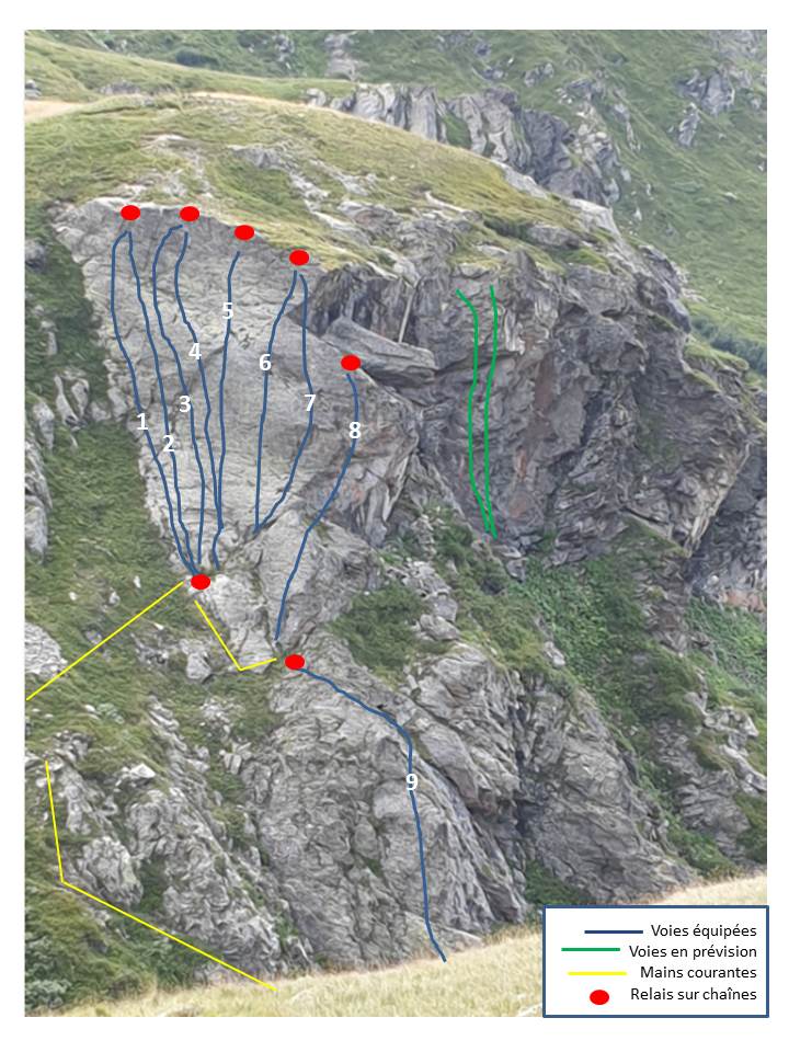
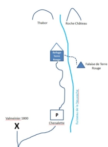
Falaise de Terres Rouges (Topo)
Very wild sector, very little frequented which asks to develop.
Ability to stay or eat at Refuge Terre Rouge 10 minutes.
Opening : in 2019 by Jean – Christian LICHAIRE, Caroline MENON and Denis VIANO
Exposition : East (IGN : 3535 OT Névache Mont Thabor)
Starting point : Refuge de Terre Rouge – about 8 minutes
Track height: from 25 to 30 meters maximum
Equipement : Cliff on equipped to allow beginners to climb in the lead. Do not touch the equipment in place.
Equipment on spits of 12 and chains to the relays. Material provided by the FFME de Savoie.
Material : 70 meter tether recommended. 12 quickdraws, lanyards and helmet.
Route
Go to Valmeinier 1800, just before the station turn right towards the parking of the Chenalette (GPS coordinates: 45 ° 09’41”N – 6 ° 29’40”E). Go up the valley along the Neuvache stream to the Terre Rouge refuge. Access to the cliff in 1h15.
From the Terre Rouge refuge go down towards the torrent, cross it, from there we see the cliff on the right. After crossing the stream 50 meters below the capture EDF, go on the right towards the cairns and locate a yellow handrail at the foot of the cliff. It is advisable to walk along the handrail to avoid slipping in the grass (GPS coordinates: 45 ° 07’50”N – 6 ° 30’44’E).
Download the topo in pdf : Topo Terre Rouge 2019
L1 “Raz les fraises” : 4A
L2 “Cool” : 4B
L3 “A gauche, toute!” : 5A
L4 “Jaunisse” : 5B
L5 “Engagez-vous” : 6A
L6 “Fastoche” : 5C
L7 “A droite, toute!” : 5B
L8 “Petit personnel à la pioche” : 5A
L9 “Momo à la cave” : 4C